

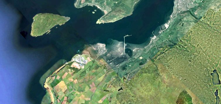
Between Portencross and Largs there is a geological fault line. It passes directly under Hunterston land. Below is an explination supplied by the British Geological Society.

© 1999 - 2022


- Home
- Estate Land
- Gates
- Farms
- Watertanks
- The Brooch
- Castle
- Woods
- Ha-Ha Wall
- Hills
- Burns
- Dump
- Buildings
- Turret Bees
- Walled Garden
- Shores
- Mansion House
- Roads
- Bridges
- Trees
- Quarries
- Flora & Fauna
- Marshes
- Roman Features
- Geological Fault
- Industry
- Archaeology
- Other Features
- Hunter Clan
- Various Images
- Planning Documents
- Location Map
- Donate
- Contact Me
The fault system in the Hunterston Peninsula area as it is shown on the published 1:10,000 scale geological map (NS14NE) is referred to in the geological literature as the “Largs-Hunterston Fault Zone”. In this area the fault zone forms the boundary between the Upper Devonian Seamill Sandstone Formation and Lower Devonian Portencross Beds. Further to the north-northwest the fault juxtaposes the Seamill Sandstone Formation against the Kelly Burn Sandstone Formation; both formations are Upper Devonian in age.
At Farland Head the fault zone has been mapped as comprising three essentially NNE-SSW-trending brittle faults. The eastern-most fault occurs on the eastern side of Farland Head where the headland meets Ardneil Bay. On the geological map (sheet NS14NE) this fault shown as being cut by an east-west-trending tholeiitic dolerite dyke of Permo-Carboniferous age. There is no obvious offset shown of this dyke shown (either on the map or accompanying reports) as it crosses this fault strand, indicating that there has been no significant movement on the eastern strand of the fault system since Permo-Carboniferous times. The western most faults form the margins of a small inlet known as Sandy’s Creek. The projection of these faults inland of the coast on map sheet NS14NE indicates that these brittle structures merge to form a single fault the east of Portencross. In this area the fault is cut by an approximately northwest to southeast-trending quartz-dolerite dyke of Permo-Carboniferous age. There is no mapped offset of this igneous intrusion, indicating that there has been no significant movement on the western strand of the Largs-Hunterston Fault Zone since Permo-Carboniferous times.
The presence of dykes cutting through the strands of the Largs-Hunterston Fault Zone in the Hunterston Peninsula area provide clear evidence that this fault has encountered very little or no significant movement since Permo-Carboniferous times. As noted above the fault zone is responsible for the juxtaposition of Lower and Upper Devonian strata (downthrow to the west/northwest), but this movement predated late Carboniferous-Permian times and probably occurred during or immediately after the deposition of the Devonian Old Red Sandstone Succession.
On the published 1:10,000 scale geological map sheet NS15SE the line of the westernmost fault strand of the curves slightly towards the north as it is projected to the north. This fault is shown as terminating immediately offshore within Hunterston Sands and has a total mapped strike length of c. 4 km. The eastern strand of the Largs-Hunterston Fault Zone is projected north-eastwards across the sheet and into the adjoining 1:10,000 geological map sheets NS25SW and NS25NW where it curves into a more north-south orientated structure; resulting in a total strike length of 9 to 10 km. On sheet NS25NW this fault is shown to terminate immediately north of Fairlie. However an apparently separate approximately north-south trending fault, labelled at the Largs-Hunterston Fault Zone is shown further to the north at Bowen Crags. However, there is a marked break of c. 1.5 km separating these two faults, consequently their exact relationship is unknown. This break in the southern and northern extensions of what has been referred to as the Largs-Hunterston Fault Zone is also shown on the published 1:50,000 scale geological map of the Irvine district and the accompanying memoir.
In the IGS report describing the geology of the Hunterston Peninsula the structure of the area is described as, “The dominant faults of the Hunterston Peninsula are those delimiting the east and west margins of the belt of steeply dipping strata and extending north-east from Farland Head to Poteath and beyond.”. No detailed description of the deformation associated with these fault strand or estimates of the amount of displacement on this fault system are published in this report. This suggests that this fault system has very little surface expression at Farland Head and is not exposed inland. Consequently quantifying the depth of penetration of this fault zone and its significance in terms of its impact on the regional structure of this part of Ayrshire is speculative.
Further to the above geological information, the BGS Seismology Team has searched for earthquakes that affected the area within a 25x25km square centred on the fault. Please note BGS never attributes any earthquake with a particular fault in the UK, as we do not have enough events to clearly indicate major fault lineations. Earthquakes of limited size in the UK, due to the geological conditions, can be generated by very small faults, only 1- 2 km long. Location uncertainties in earthquake epicentres are typically 1- 3 km currently, and larger before 1980. Since faults are very common in the rocks underlying the UK there may be quite a number of candidate faults within this radius of uncertainly for those small earthquakes. Yet, as stated above, the Largs-Hunterston Fault has not been active since Permo-Carboniferous times (359-252 million years ago) and therefore none of the recorded earthquakes (first one in 1836) in the area are likely to have been caused by this fault (see attached map and associated data).